The wide and well-defined path of x. Demysitsa for x. The Bezos go south through the forest, through the left bank of the River Valovitsa and through meadows and pebbles it reaches the Villayaveshka Riegel. After the river rigella crosses pebbly passages and leads to the area of Tyatas. Here the River Rollerathing flows slowly and quietly with many meanders. After a slight climb you pass along a small pond and the great Valavishko Lake, from where the river begins. It enters the Valavis Circus from the bilingual line connecting the peaks Of Valaviški Chuka, Momin Court, Jengal and the southern slopes of vr. Little Polejan.
The western slopes of The Jengal and The Gengal Crest are sheer granite walls about 120m high, which are the object for alpine climbs. The Great Valavisko Lake is the largest of the Valavis lake group, located at the bottom of the vast Valavički Circus at 2280 m., long is 480 m., wide 275m., deep 19m. And it has an area of 85k and a volume of 664 800cube.m. In the north, there’s a two-peak island. From here the movement continues in the eastern direction on a long climb to the Gengal Gate (2500m) – the highest point of the route. It is natural here to make a longer break, as there is something to see. Back are the wondrous Valavic circus with the lake necklace adorning it, and the front to the east has expanded the Rhodope Mountains. From here begins a steep long descent along with pebbles and rock blocks crosses small and shallow lakes. From them to the ridge of Besbed, it takes about 1.30 h.
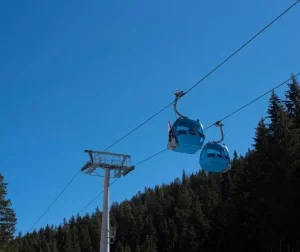
Several short climbs and descents are made on a well-defined and marked path and lead to the Godless Preval. A famous stay here is necessary to see the spacious views and relax after the long trek. From Besbog with seat rope line can be reached in about 30 min. To Gotse Delchev and from there with a pre-arranged transport for about 40 min, it goes down to Bansko.
From Vihren you can walk down the path to the Frog’s Lake, walking along a varied terrain – grassy, Stoney, and rising lonely rocks. After reaching the terrace on which the Frog’s Lake is located, from there begins the steep statement along the pebbly serpentines to the Todorina Gate Prevalla. This is the highest point of the transition (2580 m) and is located between the peaks of Malka Todorka and Vasilashki Chuka. From here begins the descent to the Vasilashki Circus.
The well-defined path through steep and pebbly slopes reaches the two Todorini lakes (upper and lower), also called “the eyes of Todorka”. The upper Todorino Lake is at 2536 m. The lower Todorino Lake is the smaller one and is located above the Vasilashko Lake by the Vasilashka Lake and reaches the Fish Basilashko Lake, bearing its name due to many trout that takes its place (2126m). Vasilashki Circus is one of the most beautiful in the Pirin. It is surrounded by the bilingual line connecting the peaks Todorka, Ovchi shaft, Vasilashki Chuhar, and The Typicals. After crossing the sea shaft Ofry Vasilashko Lake, you can walk along a path through a squat, grassy area, and coniferous forest and after about 20 – 30 min. it comes to The Demyanitsa (1895m)
Ascent of Vihren – (2914 m.p.a.)
Bansko – Vihren – (bus 30- 40 min.)
V.Vihren – (5- 7h.)
The climb to the top takes place on its southern slope, through the Kabata saddle for about 3.30 am. In addition to the same road from the top can go down the path to the northwest to the premcata saddle, from where to continue through the Grand Cauldum to Vihren.
Muratovo Lake, Robno Lake, Frog Lake, The Long Lake and Lake Eye
This route is light and accessible to a wide range of tourists and its duration is about 4 hours and the denivelation about 350m. – 400 m. The starting point for the route is Vihren (1950m) as far as Bansko can be reached in about 40 min by bus. From the hut, you can start in the southwest direction and pass along the grassy bank of The Banderitsa River through the area of Ravnaka. Then along the steep eastern slope of Muratov Peak, cross several small streams and takes us to Muratovo Lake. From here, the route continues in a southerly direction. The path is howling through squats and grassy slopes and after about 20-30 min we reach the Fish Lake – 2190 m.h., 384m. length, 230 m.width, 12 m. maximum depth, and 65 d’pm areas. A small, grass-covered, squat, and located peninsula in the southern part of the lake complements its beauty. In its waters reflect the stone wreaths of Banderiki Chukar, Donchovi Karauli, and Muratov Peak. It is also important the view of V.Vihren, which from here is revealed with all its height, and when its white marble googly is reflected in the blue waters of the lake, the view can never be forgotten. From here the trail continues to the south and takes us high on the beautiful Frogishsko Lake – 5.6acres and only 2m deep. After about 10min, we arrive on the Long Lake – 45,5dn area, 500length, 150 widths, and about 10 m. Depth. From Long Lake, the route continues back north to Lake Okoto, which stands about 15-20min from Vihren. The well-marked path descends through squats, mores, and grassy terrain, and after about 1 hour it reaches the lake – 2082m, 64m. length, 57 m. width, about 5 m. the depth and 2.6 d.e. area. In summer, its clear waters warm up to 18C, but bathing is forbidden.


